Tuesday, August 13, 2013

Herrre's Jasper!


Jasper National Park in the Canadian Rockies - check it out.

Al was fascinated with this growth.

Kind of looks like something an artist would create, doesn't it?

The entire park has views like this, one right after another.

Nice rack, right?  This is just a little patch of grass in the middle of a parking lot.
  These guys will picnic anywhere.
 

Can you see me?

Now we're in Whitefish MT and will stay until next week.  It's nice to be back in the states where prices are better and Verizon works more efficiently.  We'll play with Peter (the oldest son) and Kim, then zip across Washington to go back to Sequim and find out just what that new house is really like.
I'm trying to get used to saying 65
Posted by Picasa

Friday, August 9, 2013

Quickly!


There are so many fabulous pictures of the Jasper National Park but our wi-fi is nearly non-existant, so here is just a teaser before I log off, but will come back when we are in range of a good tower.  The Canadian Rockies are as wonderful as the US version. 
Posted by Picasa

Thursday, August 8, 2013

Hey, Beaver!


I forgot to show you this 15-foot high beaver on a 19-foot log in the 2,264 people town of Beaverlodge, the regional centre (Canadian, ya know) for grain transportation, seed cleaning and seed production.  Cereal grains, such as wheat, barley and oats, are the main crops in the area, along with a reforestation nursery which grows about 11 million seedlings a year.     
Posted by Picasa

More Beauty


Wednesday morning we left Dawson Creek early and this is what we saw for many miles.  It was a pretty but kind of boring drive, with towns few and far between.  One spot was about 100 miles with nothing.  Really.  Nothing, just a couple of turn-outs but not scenic, kind of just a wide shoulder in the forest.  The scenery changed to farm country, lots of Alberta farm country. 

Now we're in Jasper National Park.  Can you see how the earth heaved itself up and twisted around so the striations go in different directions?  Ain't that somethin'?

See what I mean?  This is just by the side of the road, where we also saw a herd of caribou, seeming to be eating gravel, but there must be something we don't know.  Sorry but the pictures are all blurry, which is what happens when the driver doesn't slow down enough to give the photographer a clear shot.  Now we're settled in an RV hook-up space (electric only, but Al figured out how to fix the water pump and we have a full tank of aqua) smack in the middle of the park and are fixin' to go exploring the Canadian Rockies. 
Posted by Picasa

Tuesday, August 6, 2013

Mile Zero


Dawson Creek, BC is the beginning of the Alaska Highway, but for us it's the end because we went North on the Alaska Marine Highway System, so did it backwards.  Like many other things.  Dawson Creek became a much larger town when the construction began and they are very proud of being the important starting point.  There is a great museum telling all about the construction of the Highway.


Did you know this?  I didn't.  In case you can't read it - it tells about what the Quonset Hut it and that it was so called because it was manufactured at Quonset Point in Rhode Island.

Tomorrow we're driving to Jasper, Alberta.  The forecast calls for thunder, lightning and rain so we'll see if our luck of driving without rain holds or if it has finally run out.  Right now it's raining like cats and dogs.  What does that mean?  I do know that it's real noisy from inside a big tin box.
  We'll be in RV parks in the hills and don't think we'll have much wi-fi, so I'll be back to tell you about it when I can.  Hang on!
Posted by Picasa

Monday, August 5, 2013

Whoa!


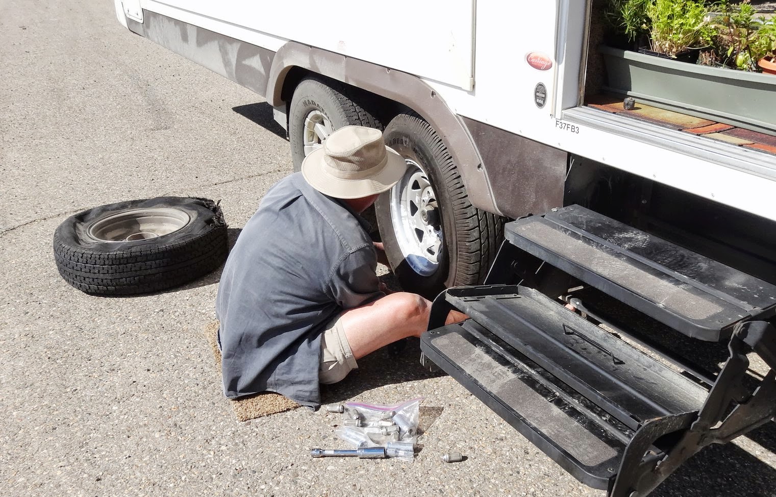
It was another driving day, from Fort Nelson to Dawson Creek, BC.  Not as many dramatic mountain formations, but still beautiful, especially if you like green.  This is the Peace River Bridge, with yellow canola fields in the distance.  Right after I snapped this, the tire sensor began shouting BEEP!  BEEP! BEEP!, frantically flashing red and STOP!  STOP!  STOP!  Not a good sign.

Now we know why.

We still can't figure out what would cause this but we were lucky enough to be right be a large turn-off when it happened.   

Once again, Al to the rescue!  Why do we pay for roadside assistance when he always does this himself?  I know, for the big things that we hope never happen.  Now we're in Dawson Creek and he has gone off to the Goodyear tire guy.  I'll keep you posted.
Posted by Picasa

Saturday, August 3, 2013

Bison and Caribou and Stone Sheep


Finally!  We've been in Alaska/Canada since June 3 and today we saw more wildlife than all the other time combined.  All of them just hanging out on the road.  Wasn't that nice of them?


Posted by Picasa

Watson Lake


Between Teslin and Watson Lake.
I'm always disappointed by the Continental Divide markers, usually finding them disappointing.  When we learned about it in school, there was always an image of it being at the top of a very high peak, with a view straight down in either direction.  Where is the drama?

This explains it all.  The guidebook says there were more than 72,000 signs as of 2012.
 
 
Posted by Picasa

Friday, August 2, 2013

Anybody Got a Dime?

 
Posted by Picasa

Happy Medicare to Me!


It's official!  I'm Old! 
But still having fun.  Yesterday's adventure was in Skagway, back in 'Merica. 
On the way we saw this amazing lake.  Did somebody say emerald
 

This is how I celebrated the beginning of the month in which I turn 65.

It was a delightful day and now we're hooking up for a driving day to Watson Lake,
 our last stop in the Yukon.  See you next time I have a decent connection.
Happy August!
Posted by Picasa